A beautiful afternoon for a bay-side walk.

Today, Easter Friday, we walked from Canada Bay along the waterfont, through Cabarita to Mortlake, near the car ferry across the river to Putney.

We love walking through areas where the home owners don’t own the water; makes for a much nicer walk 🙂

image

A beautiful path virtually the whole way.

image

The end of Durham St, Canada Bay. The start of today’s path

image

Bayview Park, near Massey Park Golf Course

imageimageimageimage

image

Looking west towards Breakfast Point

We started with breakfast at The Coal Loader Cafe. in Balls Head Rd at Waverton, where we were a few weeks ago. Beautiful spot – have to remember this as a venue for a 60th or similar.

From there we headed west, making our way around Balls Head Bay and Oyster Cove, around Berry Island Reserve and on towards Greenwich above the fuel tanks at Gore Cove, some of which have been removed, but some are still in use today, pumping fuel from here to Clyde near Parramatta.

image

Coal Loader Cafe to Greenwich Rd

image

Coal Loader Cafe. Lovely.

image

Coal Loader Cafe

image

Old wharf fallen into disrepair at Waverton below the Coal Loader Cafe

image

Old street signs art installation below the Coal Loader Cafe

image

Looking west towards Wondakiah Dr

image

Tunnel under the old Coal Loader site

image

Oyster Cove at the end of Wondakiah Dr at Waverton. Dense housing around, but lots of parkland maintained. Nice!

image

Remnant of the old gasworks at Oyster Cove at the end of Wondakiah Dr at Waverton. Dense housing around, but lots of parkland maintained

image

Berry Island – the point where land was filled to connect it to the mainland and make it no longer an island as such,

image

Berry Island

image

Berry Island

image

Looking back towards the Coal Loader

image

At the point off Berry Island

image

Along the path between Berry Island and Greenwich

image

Along the path between Berry Island and Greenwich

image

Hollaway Park

image

Hollaway Park, at the end of Vista St. Beautiful little park with a view

image

Vista St Greenwich

image

THE spot to watch the fireworks in Sydney! Greenwich Rd, above Gore Cove.

Parts of Longueville are beautiful!

We had a great walk around the streets as close to the waterfront as we possibly could – sadly, the absolute waterfront is owned by the private residences leading down to that water. Beautiful houses on big blocks of land, some nice local parks and walkways too.

Given the the tide was well out, we did try to walk around some of the foreshore, however the mangrove mud was VERY soft!

Northwood appears to be a locality inside Longueville – I only mention it in the title as this is the ferry wharf you would go to to explore this neck of the woods.

Looking forward to exploring a bit more of this area in the weeks ahead.

map

This week’s progress

IMG_6039

Dubois St Longuville. Beautiful homes fronting the river

IMG_6040

The sand was a little soft! And got a LOT softer!

IMG_6042

Arabella St Longuville. Views to the city 🙂

IMG_6043

Arabella St Longuville. Views to the city 🙂

IMG_6046

Northwood Road

IMG_6045

Looking across the bay to Woolwich (Marist Sisters College)

IMG_6044

Lovely park near Kelly’s Esplanade, near Northwood Ferry wharf

IMG_6048

Spectacular views to the city from Arabella St (and very cool front and garage doors!)

IMG_6047

Spectacular views to the city from Arabella St

The Swans v Giants pre-season footy match was on Friday night so we parked the car near Drummoyne Oval a little beforehand and headed east towards the city. Some beautiful water-front real estate, a few hidden parks. Nice 🙂

IMG_0625

IMG_5994

Rea Reserve, Drummoyne Ave

IMG_5995

Rea Reserve, Drummoyne Ave

IMG_5996

Some beautiful waterfront real estate with views east to the harbour bridge. Some places make it easier to sticky-beak than others!

IMG_5998

From Drummoyne ferry wharf

IMG_5999

Lovely little park at the end of Lyons Rd

IMG_6001

Private beach and a dog park opposite Spectacle Island

IMG_6002

Private beach and a dog park opposite Spectacle Island

IMG_6006

Drummoyne Oval

z

Drummoyne Oval. Swans | Giants pre-season. Cheap entry 😉

Italian

Posted: March 1, 2016 in Bars, Cafe, Sydney Harbour

https://sothisweekendwe.com/food/

Our mission to try every single country on the planet’s cuisine over the next few years.

Have to start somewhere! There was an Italian Riviera festival at The Opera House over the weekend.
A break in the weather and we were able to get there without too much trouble.

IMG_1466

Just like the Italian Riviera!!

italy1italy2italy5italy4italy3


We drove down to Rhodes and parked at the northern end of the path, near the railway bridge to Meadowbank.

We unloaded the bikes and headed off south along a beautiful path beside the river in front of all the new apartments at Rhodes.

As the shopping strip peters out, the path continues along the waterfront, through the Rhodes wetlands, past bird sanctuaries, recreation areas and, once we reached Wentworth Point (close to the Olympic Park), housing.

It was raining this day, so we stopped here and had a coffee before returning back a different way through the various Olympic area paths.

The following week, in bright sunshine, we parked the car and headed out from near the Olympic Archery Centre, heading west along the bike path. We rode past the Armory cafe, but had to cross the river at the bridge at Silverwater road as there’s no path through the oil refinery. The path continued on this other side of the river… we rode till it finished near Western Sydney University.

Here we turned around and rode back to the Armory Cafe for breakie. A nice morning 🙂

image

Bike paths

IMG_1529

Rhodes waterfront

IMG_1528

The Armory Cafe

IMG_1527

The Armory Cafe

IMG_1526

Looking east from near Silverwater Road

IMG_1525

Heading west towards The Armory Cafe

IMG_1524

Heading west towards The Armory Cafe

IMG_1473

Wentworth Point (near Olympic Park) from Rhodes

IMG_1471

Historic wrecks at Rhodes

IMG_1470

Bird watching refuge at the wetlands area near Wentworth Point

IMG_1469

Bird watching refuge at the wetlands area near Wentworth Point


On a beautiful, last day of summer day in Sydney, we parked the car at Waverton Station and walked south, down the hill past a small cafe towards the water.

There’s a road that makes its way around Balls Head, but the bush track below the road takes you past a remnant of (recent) old Sydney, the Coal Loader. It’s a beautiful,easy path with beautiful views of the city. Quite the spot for the New Year’s Eve fireworks.

Some beautiful waterfront along Waverton Peninsular Reserve and Waverton Oval to Sawmillers Reserve (which sadly doesn’t go right through to Blues Point.

Wander along the path near Wendy’s Secret Garden to Luna Park and the Harbour Bridge.

A fabulous walk of about 6 or 7 kilometres. Catch the train back to Waverton Station from Milsons Point Station – just 2 stops.

map2

wa1

Beautiful Harbour views along the path at Balls Head Reserve

wa6

wa3

Berry’s Bay

wa2

Beautiful Harbour views along the path at Balls Head Reserve

wa4

Beautiful Harbour views along the path at Balls Head Reserve

wa5

Remnants of the old BP storage facility. Lots of round tank holes hewn into the rock.

wa7

Sawmillers Reserve


The Goods Line is a shared pedestrian and cycle path and green public space, connecting Ultimo with Darling Harbour.

The line provides a pedestraian and cycle path from Central Station to Darling Harbour, with mixed-use spaces to enjoy – dining tables, grassy spaces, table tennis tables, study pods amongst the trees and a children’s water play area with a sand pit shaded by trees.

A fabulous re-use of what was a busy industrial railway line.

http://www.shfa.nsw.gov.au/sydney-Our_places_and_projects-Our_projects-The_Goods_Line.htm

map1

Only a short walk, but so well done

goodsline1

Past the iconic Dr Chau Chak Wing Building (designed by Frank Gehry – The “Paper Bag building”)

goodsline3

Past the iconic Dr Chau Chak Wing Building (designed by Frank Gehry – The “Paper Bag building”)

goodsline7

goodsline6

goodsline2

goodsline4


Back from our holiday to India and so ready to resume normal weekend service!

Our plan this year? We enjoyed walking the beaches and coast so much in 2014 that we decided to do the same this year, except we will hug the inland waterways. Late Sunday afternoon we headed out to Parramatta Ferry Wharf to begin walking East along the southern shore.

We parked the car at Parramatta wharf and walked towards Rosehill racecourse along the Harris Park Heritage Walk, a really nice path along the (pretty murky this far up stream) Parramatta River with terrific signposting advising various historical sites that used to be there

It’s well done; love wandering along bits of Sydney we’ve never seen before.

IMG_0608

image


image

Had to start the year somewhere, so we chose Parramatta Wharf

image

The stern of the last HMAS Parramatta

image

image

NIce work along the path

image

Robyn has taught at two schools with Ellengowan in their name. This is the original site of Tara Anglican School at North Parramatta.

IMG_5913.JPG

IMG_0608.PNG

About 200 km to go! 🙂


Week 52 ~ Z is for The End!

Posted: December 31, 2015 in history
Tags:

The end of the Alphabet.

The end of the Year.

Seemed an appropriate time to visit the end of a significant Life.

We’re currently on holiday in India, so today we went to 3 significant sites regarding Gandhi.

We left the hotel with the intention of visiting the Gandhi Smrity, the site on Tees January road in New Delhi where Mahatma Gandhi was assassinated.

However, our tuk-tuk driver took us to where Gandhi was cremated. Once again, shoes off as made our way to the venerated ground. Quite a nice, large park in the middle of busy Delhi; a bit of peace and quiet.

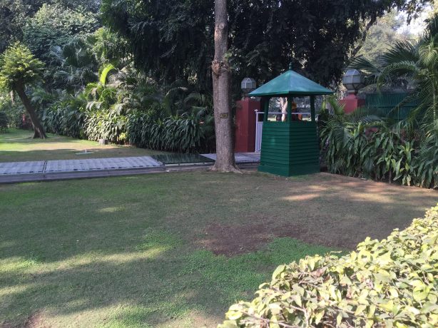
From here we asked another tuk-tuk driver to take us to Gandhi Smrity, but alas, we were taken to where Indira Gandhi was murdered by her own body guards. It’s at the house where she (and her son, later Prime Minister Rajiv) lived. Her last steps are commemorated by a glass path, and where she fell is identified by a clear glass panel. Obviously a very revered figure, the museum was chockers with local Indian tourists seemingly intent on capturing any photo as evidence that they had visited rather then reading any of the exhibits.

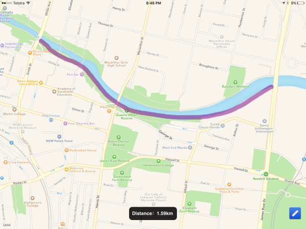
A quick check of the map revealed that we weren’t far from where we wanted to go, so rather than risk another failed tuk-tuk attempt, we headed off on foot.

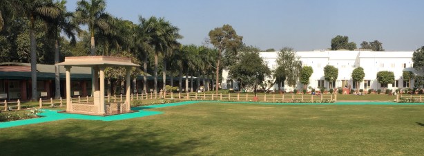
We’re glad we did… we found the quietest, most beautiful part of Delhi that exists I think. Beautiful tree-lined streets, and guards and soldiers with machine guns every 50 metres or so keeping the hoi polloi at bay.

We were surprised to find the museum and grounds almost deserted… as such a significant figure, venerated for his role in gaining independence for India, there were bugger-all people there.

The museum display was pretty good, with plenty of information about his life and thoughts for India.

Something that stood out for me was his enthusiasm for women to be respected, educated and considered equal. Alarming and the path of his last walk and where he was shot (by a disgruntled Indian nationalist) are nicely maintained.

The irony of being shot like that, after a lifetime of advocating peace and unity.

24000350171_2e4441ba94_b

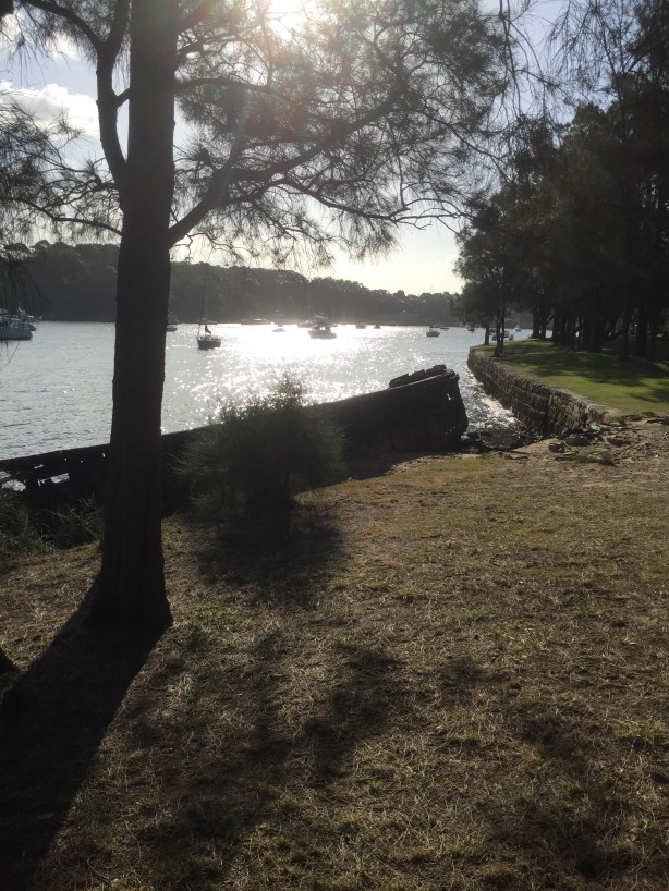
Mahatma Gandhi’s cremation site

23801749250_7cc58d32fc_k

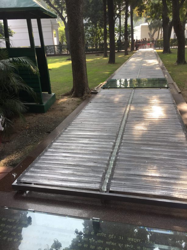
Indira Gandhi was assassinated along this path. Where she actually fell is under the sheet of glass.

23454711454_4e8269777c_k

Indira Gandhi

23715145129_d1b9c35c7a_k

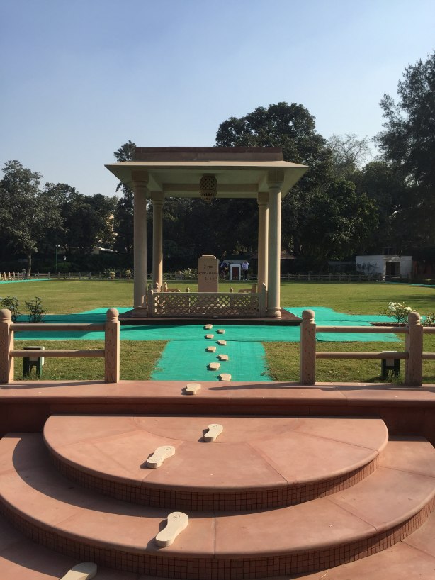
Mahatma Gandhi’s last steps

24082927665_c72d7e9b63_k

Mahtma Gandhi assassination area.

23989085852_cedec313b1_k